


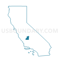
Voting District 10070, Kings County, California
About
Outline

Summary
| Unique Area Identifier | 532425 |
| Name | Voting District 10070 |
| County | Kings County |
| State | California |
| Area (square miles) | 11.05 |
| Land Area (square miles) | 11.05 |
| Water Area (square miles) | 0.00 |
| % of Land Area | 100.00 |
| % of Water Area | 0.00 |
| Latitude of the Internal Point | 36.27462690 |
| Longtitude of the Internal Point | -119.92394260 |
Maps


Graphs
Select a template below for downloading or customizing gragh for Voting District 10070, Kings County, California


Neighbors
Neighoring Voting District (by Name) Neighboring Voting District on the Map
- Voting District 10160, Kings County, CA
- Voting District 30885, Kings County, CA
- Voting District 30890, Kings County, CA
- Voting District 30905, Kings County, CA
- Voting District 30910, Kings County, CA
- Voting District 42870, Fresno County, CA
- Voting District 43015, Fresno County, CA
Top 10 Neighboring County Subdivision (by Population) Neighboring County Subdivision on the Map
- Lemoore CCD, Kings County, CA (36,350)
- Stratford CCD, Kings County, CA (16,634)
- Huron CCD, Fresno County, CA (7,991)
Top 10 Neighboring Place (by Population) Neighboring Place on the Map
Top 10 Neighboring Elementary School District (by Population) Neighboring Elementary School District on the Map
- Central Union Elementary School District, CA (10,904)
- Island Union Elementary School District, CA (1,478)
Top 10 Neighboring Secondary School District (by Population) Neighboring Secondary School District on the Map
Top 10 Neighboring Unified School District (by Population) Neighboring Unified School District on the Map
- Coalinga-Huron Joint Unified School District, CA (26,275)
- Riverdale Joint Unified School District, CA (6,108)
Top 10 Neighboring State Legislative District Lower Chamber (by Population) Neighboring State Legislative District Lower Chamber on the Map
Top 10 Neighboring State Legislative District Upper Chamber (by Population) Neighboring State Legislative District Upper Chamber on the Map
Top 10 Neighboring 111th Congressional District (by Population) Neighboring 111th Congressional District on the Map
Top 10 Neighboring Census Tract (by Population) Neighboring Census Tract on the Map
- Census Tract 3, Kings County, CA (7,446)
- Census Tract 78.02, Fresno County, CA (5,269)
- Census Tract 16.01, Kings County, CA (4,516)
- Census Tract 78.01, Fresno County, CA (2,722)
- Census Tract 2, Kings County, CA (2,271)